|
BIOL 4140
Contemporary Problems
in Environmental Science
Phil Ganter
302 Harned Hall
963-5782 |
|
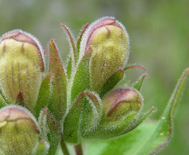
Digitalis (Foxglove)
flower buds- the plant is the source of one of the earliest
(1785) purified therapeutic drugs, the cardiac glycoside digitalin,
which can help to regain regular heart rate by interfering
with the Na+/K+-pump, causing a buildup of sodium within the
cell,
which
increases
the contractility
of
heart muscle |
The Earth
Chapter 5
Email
me
Unit
Organization:
Reading:
Textbook: Chapter 5
Ancillary Reading:
Plate Tectonics
In
the 1960's, geology moved from a static view of the Earth's surface to a
dynamic view, due to several new sources of data
- One
source was the magnetic striping of the ocean floor due to Geomagnetic Reversals
- Geomagnetic
Reversal - a flip-flop in the polarity of the Earth's magnetic field (N become
S and vice versa)
Now
geologists believe that the building (in Latin, tectonicus) of the
Earth's surface features is due largely to the motion of part of the upper
mantle that breaks the solid crust into plates and moves them, resulting
in Continental Drift
- The
mantle motion is not uniform, resulting in Hot Spots, where the mantle may
cause volcanism on land or sea, sometimes building islands, or may cause intrusions
of magma under the continental rock, which can cause faulting and mountain
building (Orogeny)
- The
movement in the mantle
results in boundaries (edges) between plates that can be
- Static Boundaries (not
moving)
- Faulting also
called Strike-Slip Boundaries (sliding past one another)
- San
Andreas Fault in California
- Spreading Boundaries of
two plates moving away from one another -
- Mid-Oceanic Ridge
- Rift Lake
- Colliding Boundaries cause
overlap of the colliding plates, with one plate riding over the other
- Subduction
Zone
- Oceanic
Trench
- Orogeny
- The
large amount of kinetic and heat energy associated with collisions and hot
spots causes Volcanism and Earthquakes there
Plate motion is slow, ranging from 1 to 12 inches
per year but, given millions of years, the surface of the Earth was very
different in the past and will be different from today's configuration
in the future
- At 1 inch per year, it would take about 1.5
bya to go around the world at the Equator
- Continents have been aggregated into Supercontinents
in the past
- Most recent supercontinent is Pangea (or Pangaea),
which formed about 300 mya and broke in two (Laurasia and Gonwanda) from
about
200 mya to 140 mya
- Fossil (and some living organisms) distributions
are evidence of the existence of the supercontinent
Rocks
Rocks
are mixtures of minerals
- Minerals are
crystals of consistent chemical composition (like Quartz, which is Silicon
dioxide)
Kinds of Rocks
Igneous - formed by cooling Magma or Lava, this is the parent rock from which other
rock types are made
- Some
(Gabbro and Basalt) are very similar in composition to the mantle materials
- Plutonic - formed by the intrusion of magma close to the surface, where it can cool
slowly and produce large mineral crystals within the rock
- Volcanic - formed by the rapid cooling of lava ejected from volcanoes, these form
fine-grained rocks as large crystals do not have time to form
Sedimentary-
rock that forms in three ways
- Clastic
Sedimentary Rock - pieces of rock (from weathering of other rock) collect
in beds which are buried below newer sediments and are cemented (chemically
connected) by the pressure and heat
- Biogenic
Sedimentary Rock - from shells, etc. - mostly CaCO3 (Limestone
and Dolomite) but also SiO2 -
- Chemical
Precipitates - stalactites and stalactites in caves, travertine terraces
at geysers,
- Diagenesis is the process of change that begins with the buildup of sediments and ends
when the rock is under such high temperature and pressure that metamorphosis
begins (see below)
- Lithification is the part of diagenesis that cements the particles together
- Sedimentary
rock has pores in it (spaces between the sediments) and originally filled
with fluids
- Diagenesis
reduces pore size through pressure but does not eliminate the fluids
- Usually
water but can be natural gas or petroleum
Metamorphic
rock - when sedimentary rock is taken deep enough into the Earth to experience
temperatures and pressures that alter the rock structure
- Time,
heat, and pressure are the three elements of metamorphosis
- Foliated
Metamorphic Rock
is layered as the slow squeezing of the original rock flattens and
aligns
the
crystals
into
visible
layers (Gneiss)
- Non-Foliated
Metamorphic Rock has no obvious layering, although it often has patches of
different color or shade in it (Marble )
The Rock
Cycle
- The
Rock Cycle begins with molten magma that cools to form igneous rocks
- Igneous
rocks are broken apart by Weathering
- The
pieces of rock that are produced collect as sediment beds and are buried
by later sediments
- As
more sediments collect above, the particles are subjected to both pressure
and heat
- Sediments
are turned into rock once they are buried, where they are
cemented together (lithified)
- Subduction takes
sediments down into areas of great pressure and heat where one of two
things happens:
- metamorphosed
by pressure and heat
- melted
- start cycle over as new igneous rocks
- Uplift (mountain building or Orogeny)
may bring metamorphosed or sedimentary rocks to surface, where they too
are weathered
More on Climate
Climate
and Weather differ in scale in both space and time.
- Average
conditions are important descriptors of climate but averages are not sufficient
for the purpose
- Maximum
and minimums are also important.
- Extreme
events may also be important.
- Hurricanes
are very important components of the climate of southern Florida but they
do not affect long-term
averages very much.
Solar
Radiation and the Earth
Electromagnetic
radiation
- Basic unit is the photon,
a packet of energy that travels as a wave
- waves have lengths (distance
from successive peak to peak) and frequency (number
of peaks passing a fixed point per unit time)
- since the speed of light is a constant,
the frequency is related to the wavelength in that shorter
wavelengths have greater frequencies
- the wavelength (and frequency) of electromagnetic
radiation is determined by the amount of energy in the photon - greater
energy causes shorter wavelengths
- all bodies with a temperature above absolute
zero (just zero on the Kelvin scale) radiate energy
- the higher the temperature, the shorter the
wavelength
Consider an
iron bar in a blacksmith's furnace. As it heats it begins to
give off visible radiation. It starts to glow red and, as it
heats more, it glows with a white light. There are some
lessons to be learned here.
Why red first? Heating
is not uniform throughout the rod, and each region emits photons
directly related to the temperature at that spot. Red light
has the longest wavelength of visible light and so, as the iron heats,
the hottest areas will appear red, the first wavelengths of electromagnetic
spectrum we can detect with our eyes. As the rod continues
to heat, more areas are hot enough to emit visible radiation
but, once again, the actual temperature is not uniform and so
we get a
wide range of photons with wavelengths in the visible spectrum
and we perceive the overall effect as white light, since there
is no
one wavelength of light that is white.
Second Lesson -
Objects with the temperature of our sun emit most of their radiation
in the visible spectrum. This is not a coincidence. We
evolved eyes to detect at these wavelengths as they dominate the
spectrum available to us because we are close to the sun. Note
that we do not detect all of the common wavelengths given off by
the sun. We do not see ultraviolet, which has wavelengths shorter
than the shortest we can see. Other organisms (not just animals!)
can detect these but we name the visible spectrum for what humans
can see, not for what all living organisms can see. A collective
name for the radiation given off by the sun is shortwave radiation
(from about 100 to 2000 nanometers).
Third lesson -
radiation is emitted by the rod before we can see it glow. In fact,
radiation is emitted from all objects, including you. However,
the wavelengths emitted by you are too long for our eyes to detect. When
special cameras that do detect at our wavelengths are used, we do glow. This
is the basis of night vision. Images are made from the glow of
objects that emit in the Infrared range
of wavelengths and translated into wavelengths that we can see by the
night vision apparatus.
Fourth lesson -
infrared means below red. Thus, it is radiation with wavelengths
below our power to detect as the photons do not have sufficient energy
to initiate the physiochemical reactions we call vision. Infrared
is divided into two types, near and far. Near
Infrared has wavelengths
near to visible (from about 700 to 4000 nanometers). Far
Infrared is even longer
wavelength (about 4000 to 1 million nm). This is the range emitted
by objects at the temperatures we have on Earth and so we also refer
to this as Thermal
Radiation.
The radiation discussed here is not the entire
spectrum. Gamma ray and X-ray radiation have shorter wavelengths
than the radiation discussed here and can have wavelengths as short as
a millionth of a nanometer. Radar, radio, TV, and cell phone use
radiation with wavelengths longer than far infrared (up to hundreds of
meters long). To see the entire spectrum, go to this site at the Laboratory
for Atmospheric and Space Physics.
Heat
and Radiation
Recall that heat is kinetic
energy, the energy of moving and vibrating atoms and molecules. Temperature
is determined by the average speed of that motion (e. g. hotter gasses
and liquids have faster moving molecules). Electromagnetic radiation
is converted to heat when photons are absorbed by atoms and the atoms
move or vibrate faster as a result (we measure this as an increase in
temperature). Heat
energy is converted to electromagnetic variation when a photon is emitted
by
a
moving atom
that slows as a result of the loss of energy (we measure this as cooling).
Global
Heat Budget
The sun contributes almost all of the energy
that drives climate and, ultimately, living systems. The sun's
contribution is in the form of electromagnetic radiation Earth
receives energy as photons from the Sun.
- The energy balance at
the surface of the Earth is result of losses to space and the
incoming radiation from the Sun. Thus,
we can do a budget, just like a household budget is the record
of income and expenditures.
Heat energy is transported
either through:
- Conduction (transfer
of heat energy from molecule to molecule in a solid),
- Radiation (conversion
to photons and loss through space) or
- Convection (transfer
to molecules in a fluid - either gas or liquid).
Budget Figures
As sunlight reaches the Earth
(at an energy density of 100% = 342 Watts/square meter)
A watt is one joule of energy
produced or consumed per second, recall that 624 billion visible photons
add up to one erg of energy, and that there are 10 million ergs in a
joule, so the input of the Sun is 2 billion trillion (2,000,000,000,000,000,000,000)
photons per second striking a square meter above the atmosphere at the
Equator
However, only 48% is absorbed
by the surface or the Earth -- 52% is never absorbed
- 23% is absorbed by the atmosphere,
23% is reflected , and 6% is reflected by
the surface
of the Earth
At the surface of the Earth,
energy is received from two sources
- the sun (48
percentage units)
- thermal radiation from
the atmosphere (100 units)
- The 100 units from the
Atmosphere is the famous Green House
Effect as
gasses in the atmosphere absorb thermal radiation from the
Earth and return most of it to the surface. Our effect
on the concentration of greenhouse gasses is the basis of the
worries about global warming.
and energy is lost through
three processes
- evaporation (25
units) - evaporation is the loss of faster moving water molecules from
water.
- convection by
the atmosphere (6 units)
- Air is
heated by the Earth and expands, which decreases its density,
and it rises as cooler, denser air displaces it at the
surface. This convection constitutes
a loss of energy from the surface of the Earth,
- thermal radiation (117)
- The infrared "glow" of the Earth's surface is a loss
of energy
As you can see, the largest
flow of energy is thermal radiation (117units from the
Earth, 100 back from the atmosphere
- Thus, changing the effectiveness
of the greenhouse effect can significantly alter the budget and trap
more heat at the surface
- Note that the budget
is balanced at the surface (48 + 100 = 148 units of
energy
gained
and 25 +6 + 117 = 148 units lost)
Climate - A
general description of how much heat and moisture characterize a region and
the timing of the minima and maxima for both.
Partially results from the curvature
of the Earth on density of solar insolation
- curve spreads density of solar
radiation over greater surface area at poles than equator
- sunlight has to travel through
more atmosphere at poles than equator due to decreased angle
- poles are colder because of
this, but this is not the reason for
Seasonality in
temperature is a result of the tilt of Earth's axis, which
changes both the day length and intensity of the sun in a regular way each
year
- the tilt is 23.5° which enables
us to divide the earth into latitudinal regions
- Arctic and Antarctic Circles
- dividing
line between those regions that get at least one day of 24 hr
of sunlight at height of summer,
24 hr of darkness in depths of winter and those regions that
get some dark and light periods every day
- Equator - Circumference midway between N and
S poles
- Tropics - regions of earth where the sun is
directly overhead at least once a year
- go from 23.5° N (Tropic
of Cancer) to 23.5° S (Tropic
of Capricorn)
- tilt divides up the year as
well as the Earth
- Solstices (Summer
and Winter) - shortest and longest days of the
year
- Equinoxes (Autumnal
and Vernal) - days on which there are 12 hrs of
sunlight and 12 hrs of darkness
Wind
patterns are
caused by the effects of insolation and the rotation of the Earth
- unequal heating causes winds as
warm air rises and colder air move in to fill space vacated by heated air
or vise versa, warm air moves in to fill space vacated by sinking, cooling
air
- hot air rises at equator
and moves north where it sinks and then moves toward equator again
- such circulating movement
is a Convection Cell
- zone of heating is where hot air
rises
- rising air condenses the
water it holds and rain results
- air tends to be moist because
it has been in contact with surface of Earth
- Subsidence
Zone is where air in upper atmosphere cools,
becomes more dense, and sinks Earthward
- air is dry as there is no
source of moisture and what the air contained was lost
by rains when air first rose to upper levels of troposphere
- The circulation
is not a single cell in each hemisphere, but is complicated by cooling
of air before it reaches the poles
- hot air rises at equators and moves
to about 30° N and S, where it cools and subsides
- hot air also rises at about 60° N
and S and moves both N and S
- Movement toward equator cools at
30° and subsides with air from equatorial heating
- Movement toward pole cools at pole
and subsides there
- this results in three
convection cells in each hemisphere (from north to equator):
- Polar Cell - 60° N or S rising air
to polar subsidence
- Ferrel Cell- 60° N or S rising air
to 30° N or S subsidence
- Hadley cell- equator to to 30° N
or S subsidence
- Coriolis
effect
- caused by moving N or
S on rotating Earth
- earth is rotating from left to right,
if you look at globe on a page with N pole facing top of page
- person standing motionless
on equator revolving faster than is person standing at polar circle
- so as one moves toward equator,
one enters a faster region from a slower one
- objects in motion seem to
be deflected to left as they are moving slower (to the
right) than their surroundings
- moving away from equator, one enters
a slower region from a faster one
- objects in motion seem to
be deflected to right as they are moving faster (to the
right) than their surroundings
- Regions
of Winds result
from combination of convection cells and coriolis effect
- Horse
Latitudes - 30° N or S subsidence zones - no winds
as air is sinking but not rushing to fill a void
- Doldrums-
equatorial zone of rising air - no winds as air is rising but not
rushing to fill a void
- Trade
Winds - zone between horse latitudes and doldrums
where air is moving toward equator and is deflected to the
right in the Northern Hemisphere (left in the Southern), so
it appears to come from the northeast (southeast
in southern
hemisphere)
- called trade winds because they
were much used by trade shipping to get from Europe to Americas
- Westerlies -
zone between horse latitudes and 60° (N and S) - zones of rising
air where air is moving away from equator and is deflected to the
right
in the Northern Hemisphere (left in the Southern), so it appears
to come from the southwest (northwest in southern hemisphere)
- Ocean Currents -
Steady winds cause water to move in large
masses called currents
- because moving water
is replaced by surrounding water, surface currents pushed by wind
tend to form large circular movements called Gyres that
circulate around an oceanic basin
- pushed by westerlies
the gyres move counterclockwise in southern hemisphere clockwise in northern hemisphere
- results in moving warm
waters northward or southward where, when they contact land, they
can warm the climate of the land
- example is the Gulf Stream in
the North Atlantic, which so warms western Europe that palm
trees grow in southern Ireland
- can also move cool water
south (must do so to replace water moving north) with the opposite
effect on the land's climate
- California Current is
responsible for the coolness of weather in central and
northern California
ENSO
El
Niño Southern Oscillation (ENSO) is the periodic (meaning recurring at
somewhat regular intervals - 3 to 7 years in the case of ENSO) change in
atmospheric
conditions over the Equatorial Pacific Ocean that results in widespread changes
in weather patterns worldwide
Heating the Pacific
Most
years, a convection cell is created when hot water rises over heating Pacific
ocean and moves eastward at high altitude
- Air
cools and descends in Americas and flows back to the hot spot in the eastern
Pacific
- Air
moving from east to west over surface of the Ocean pushes water in that direction
- As
water is pushed west, it is replaced by upwelling water along the western
coast of South America
Effects:
- Upwelling
produces algal blooms and fish fatten on the abundant productivity
El Niño
hot
spot migrates eastward, hot air rises over eastern Pacific and sinks over
western Pacific
- Warmer,
drier winters in mid and western US, wet and cool in southern US
- Dry
summers in much of Southeast Asia - can cause failure of the Monsoon rains
important to the water budgets for the area
- May
suppress Hurricanes in Atlantic and probably do in the Pacific
- Surface
current is reversed and water piles up on eastern edge of the Pacific so
upwelling off of the coast of South America is suppressed and South American
fisheries suffer
La Niña
L
Niña years - hot spot located farther west and rainy region moves further
west during summers
- Cool
and wet winters for northern US, dry and warm for southern US
- Heavy
rains and sometimes flooding for Southeast Asia
- Dry conditions in East Africa
The
Southern Oscillation is the
change in pressures associated with rising hot air (low pressure) and sinking
cool air (high pressure) that one observes as the heated air (the low pressure
area) follows the moving warm seawater in the Equatorial Pacific Ocean
Natural Hazards
Disturbance
and Landscapes
- Disturbances are
short-term events that disrupt communities and may even alter the composition
of landscapes
- Examples: fire, drought,
windstorms and tornados, cold spells, floods, epidemics (happens
in both animals and plants as well as in human populations),
volcanic activity, rock and mud slides, avalanches, ice storms
- Individual events have
two landscape properties:
- Intensity of
the event - measured in terms of the loss of individuals
(biomass) or habitat
- Scale of
the event - the area affected by the disturbance relative
to the size of the landscape under consideration
- Disturbance
Regime - the recurring pattern of a particular type
of disturbance (i. e. fire regime, hurricane regime, etc.)
- Regimes have both intensity
and scale but add the dimension of frequency - how often disturbances
occur
Hazards of Geological Origin
Earthquakes
- Caused
by sudden slippage of one mass of rock past another mass of rock
- Sudden
conversion of tension energy into kinetic energy
- Shock
waves propagate from center and can shake surface many miles away
- Can
change surface abruptly and cause seismic waves (tsunamis)
- Tsunamis
are not regular waves as the surface of the ocean does not return to the
same level after the wavefront passes a point
- When
they arrive on land, cubic miles of water may suddenly flood coastal
regions
- Measured
by either a logarithmic scale based on the energy released (Richter scale
or the similar Moment Magnitude Scale) or on the Mercalli scale, which measures
the intensity of shaking
- Earthquakes
centered closer to surface cause more shaking, so two quakes of the same
MMS magnitude might have very different Mercalli scores
- The
actual center of the slipping rock is the Hypocenter, which can be deep under
the surface
- The
point on the surface directly above the hypocenter is the Epicenter, which
is what is usually reported in the press
Volcanoes
Volcanoes
are ruptures in the crust where three things from the mantle escape:
- magma -molten rock, called lava when it escapes to the surface
- volcanic
ash - when expanding gasses explosively throw magma into air, it cools as
ash
- gasses
(H2O, CO2, SO2, HCl, HF are the majority)
Volcanoes
are associated
with Hot Spots, Spreading Zones between diverging plates
and Collision Zones of converging plates
- There
are lots of types of volcanoes, from simple fissures to large mountains
- Volcanoes
are located under water (submarine volcano) and under icecaps
- Volcanoes
can be active, dormant or extinct
Volcanism
(the level of volcanic activity) has varied over geological time
- Huge
eruptions have covered large areas (thousands of square miles) with Flood
Basalts (remember that basalt forms from rapidly cooling
lava)
Hazards
occur both locally (ash covers crops and cities, lava flows destroy fields
and buildings) and at great distances (ash clogging jet engine intakes, weather
changes thousands of miles away)
- Volcanic
Winters have followed large eruptions that eject SO2 aerosols
into the Stratosphere, where they persist as rain rarely forms
as high as the stratosphere (rain
washes the droplets out of the atmosphere)
- The
droplets change the reflectivity of the atmosphere (its Albedo) so more sunlight
is reflected and not absorbed so the Earth cools
- Can
last for up to 5 years
- Pinatubo
in 1991 cooled Earth for 2 years
- 1883
- Krakatoa (Indonesia) exploded - 4 cold years, record snowfalls worldwide
- 1815
- Mt. Tambora (Indonesia) - "Year without a Summer" in
US - June Snow in New England's, July frost in New York
Land Instability
Landslides
come in many types: mudslides, debris flows, land slumps, rockfalls and others
- Triggered
by heavy rains that saturate the soil and create surface runoff
Avalanches are collapses of unstable layers of snow and ice on steep mountains slopes
that may be triggered by new snowfall or by skiers!
Exploding Lakes
Gas
(CO2 or
Methane or even H2S)
may accumulate and saturate the water of a large lake when the lake does
not mix deep and surface waters
- Gasses
come from volcanic leakage into bottom of lake or from decomposition
- A
thermocline divides the lake into dense, cool water and less dense, warmer
surface water (the thermocline is the narrow band of water between the warm
upper and cool deeper waters)
- thermoclines
are seasonal in temperate climates but can be virtually permanent in tropical
lakes
- Gasses
build up due to pressure of water above and cooler temperature, like a bottle
of champagne
- When
something happens (earthquake, windstorm, rainstorm) to shock the gasses
out of the water, they expand as bubbles and the bubbles cause the water
to move toward the surface, where the lowered pressure allows further degassing
and the gasses erupt over the lake
- Cloud
of CO2 passes
over adjacent land downwind
Three
lakes identified as potential problems: Kivu (border between DR Congo and Rwanda),
Nyos, and Monoun (both in Cameroon)
Two
know explosions: Monoun in 1984 (37 people asphyxiated and
Nyos in 1986 (over 1700 people asphyxiated)
Today,
attempts are being made to bring enough water to surface in a controlled
manner to keep gas pressure low enough at deeper layers to prevent explosion
- Simply
a pipe that goes from surface to bottom, started with a pump but degassing
process in the pipe makes it self-operating after start
- Water
spurts out of the pipe to a height of 120 feet
- Monoun
has been degassed and Nyos is being degassed
Hazards Related to Weather
Wildfire
- Wildfires are uncontrolled fires
that burn naturally occurring fuels (vegetation, coal, peat)
- Wildfire frequency
in an ecosystem is negatively correlated with rainfall, so areas or seasons
with low rainfall
are
fire-prone
- El Niño, La Niña, droughts,
and dry winds (Santa Ana Winds in California) are all weather phenomena
that can alter the probability of wildfire occurrence
- Fires are initiated by:
- natural
events, usually lightning strikes but also volcanic activity, sparks
from rock falls, or even spontaneous combustion
- human activity - in some
regions, arson and carelessness (campfires, cigarette butts) are the
prevalent human causes but in much of the world (Mexico, Central and
South America, Africa, Southeast Asia) wildfire is used to either
clear forested land for grazing or planting (Slash and Burn
Agriculture)
or cleared areas are burned to keep the forest from returning and to
promote grass growth for grazing domestic animals
- Some landscapes
have fires so-frequently and of such scale and intensity
that the species that live there have adapted to a fire regime that
prevents other species from invading the community
- the Fire-Adapted Community is sometimes called a fire-climax community
- Types of wildfires (there are
other classification schemes)
- Underburns are
fires of low intensity and small scale burn off the litter and singe
the lower trunks of trees but do not burn the foliage of mature trees
- Ground
fires use subterranean fuel such as dead roots,
buried leaf litter, peat, and coal
- Brush fires are
intense fires in shrublands and grasslands
- Crown Fires reach
the tops of trees and spread from tree crown to tree crown
- These fires spread
faster as the wind speeds are greater above the canopy
- Greater heat is
released and these fires kill trees
- Firestorms are
the most intense fires that produce gale-force winds along the surface
as air rushes in to replace the air rising above the fire zone
- Only occur where
a large amount of fuel has accumulated
- Coal Seam Fires -
fires fueled by underground coal deposits, can burn for many years,
can cause environmental hazard (toxic gasses, land subsidence, CO2
release to the atmosphere) - there are thousands of these fires burning
right now
- Intense crown fires, brush
fires and firestorms can permanently alter the landscape as they
can burn off the organic content of the soil which can make the
soil unable to support new tree growth
- Humans influence fire
regimes
- Some cultures have
historically initiated fires to maintain grasslands (Northern
Australia, Western USA)
- In the USA, we have
historically suppressed fires
- This can lead
to fewer fires, but can increase the intensity when they
do occur if fuels accumulate
- In our
western forests, the climate is so dry that decomposition
does not, on average, consume the leaf and branch
litter that falls each year, which leads to fuel
accumulation over the years
- International Aspect
- Africa, Brazil and the drought-fires in southeast asia
- Fire management
in the US now includes periodic, low
intensity burns to reduce fuel accumulation
- Questions
remain about what to do about natural fires
- Suppressing
them can lead to worse fires in the future
but, when the fires are frequent (in dry
or drought years) or threaten human habitation
or activity (smoke can make it hard to work
outside and can harm those with respiratory
problems), suppression may be the proper
course
- Controversy
also surrounds the practice of removing dead
tree trunks after fire has killed them. These
can be valuable in the short term to logging
companies but may delay the recovery of the
forest as they may promote new tree growth
as they decay
Storms: Tropical
Cyclones (Hurricanes and Typhoons), Ice Storms, and Thunderstorms with
Tornados
Tropical Cyclones
Can
be called either hurricanes (Atlantic) or typhoons (Pacific)
Storms that are generated by warm ocean temperatures causing water-saturated
air to rise
- The
expanding air causes low pressure and some of the lowest barometric readings
have been taken during tropical cyclones
- They
spin because of the Coriolis Effect, so they spin counterclockwise in the
Northern Hemisphere and clockwise in the Southern
Hemisphere
- As
it rises, the air cools and the water vapor condenses and precipitates
- When
enough energy is available, the wind speeds reach hurricane strength
Tropical
cyclones are important parts of the heat budget as they transfer heat out
of the tropics
Tropical
cyclones can cause damage along coast from both winds and flooding
- Wind
damage may be worsened due to the thunderstorms and tornados spawned by the
cyclone
- Flooding
is due to heavy rain and to the storm surge
- Tropical
cyclones can also cause flooding inland due to heavy rains
How
much damage a storm will do is very variable and depends on the strength
of the storm in both wind speed and amount of rain and what land it passes
over
- Only
3 storms were category 5 (the strongest storm level) when they made landfall:
(1935), Camille (196), and Andrew (1992)
- Barometric
pressure is a measure of storm strength and the lowest for a hurricane was
Hurricane Wilma (2005, 882 millibars) and Typhoon Tip (1979, 870 millibars)
was the strongest in the Pacific
- For
comparison, Hurricane Katrina happened in the same year as Hurricane Wilma.
- Katrina
made its second landfall on the Gulf Coast (Florida was first) as a category
3
storm
but
at its strongest,
out
over
the Gulf,
reached a low pressure of 902 millibars.
- Katrina
did far more damage than Wilma
Thunderstorms
Also
called electrical storms due to associated lightening
- Lightening
causes the thunder that warns of the storm’s approach
Occur
where warm, moist air is rapidly carried aloft at either a front where cool
air pushes under the warm or where the Sun’s heating of the land causes
the moist air to rise rapidly
- If
associated with a front, storms often from a long, thin line of storms
along the edge of the front
- Rapid
Adiabatic Cooling (cooling
caused by expansion of air as pressure drops) leads to condensation of
a cumulonimbus cloud and to heavy precipitation
- Coriolis
effect and other forces may lead to rotation of storm
- Rising
air causes strong, in-line winds as cooler air rushes in to fill the space
Cause
damage from winds, flash flooding from heavy rain, and hail
- Can
spawn more dangerous winds: tornados
Tornados
Violent
rotating downdrafts that reach from cloud to ground and are associated with
thunderstorms
- Wind
speeds up to 300 mph, up to 3 miles wide, can stay on the ground for many miles
(record is over 200 miles)
Can
occur on any continent but most common in certain areas (US, Canada, Europe,
etc.
- Farming
and tornadoes go hand-in-hand
- The
majority of tornadoes occur in the US
- Can
occur over water as a waterspout
- Can
have multiple funnels (vortexes or vortices) from one thundercloud
Most
commonly used scale is the Fujita (F0 to F5 – theoretically
an F6 is possible but has never been measured, as the wind speed would have
to exceed
320 mph)
- Strongest
tornados form in Supercells
- These
are thunderstorms, often found in front of an advancing front, with a large
layer of rotating winds at midlevel
in the storm system (a mesocyclone)
- Formation
of the funnel cloud is not well understood
- Weather
patterns that lead to tornado formation include warm, moist air from the Gulf
of Mexico moving northeast and colliding with cold, dry air from the western
US moving southeast
Tornado
deaths vary greatly with year as incidence, intensity, and circumstance must
all conspire to create the truly tragic disasters that are deadly tornadoes
- Since
1925, deaths per million of population have fallen at a steady rate
- The
April 25-28 2011 Super Outbreak consisted of 359 confirmed tornadoes in 21
states and Canada
- There
deaths in six states (AL, MS, TN, AR, GA, and VA), with Alabama most severely
affected
- At
least on F05 tornado was detected
- It
was the fourth most deadly outbreak in US history
Ice Storms
Ice
storms form when a layer of warm (just over freezing) air is trapped between
two colder (below freezing) layers
- Precipitation
starts in upper layer and is frozen
- Then
falls through the warm layer melts
- Supercooled as it falls through lowest layer
- Supercool
water is liquid but below the freezing point
- When
supercooled droplets contact any surface at or below the freezing temperature,
crystallization is
almost instantaneous
- So,
ice forms on any cold surface
Worst
ice storm: 8 inches of ice in northern Idaho in 1961
- Locally,
the February 4, 1994 ice storm caused over $1 billion of damage in 3 states
(Al, TN, and MS)
- Worst
in North America was up to 4 inches in 1998 in NE US and Quebec
- 1.25
million homes without heat for up to a month
Floods
Floods
are the rapid rise of body of water (lake or river) caused by rainfall somewhere
in the body’s watershed
- Flash
floods are local rises in water level due to a single storm’s
precipitation
- Floods
are normal events in that all rivers flood when too much rain
falls
- Floods
can be periodic if rainfall is periodic
- Floodplain is a flat area adjacent to a river that is flooded by periodic
floods
- Floodplains
are valuable land for agriculture, industrial, and residential purposes
- By
looking at historical records, statisticians can predict how often a periodic
flood will reach a given level
- We
use these predictions to draw 10-, 50-, 100-, and 500-year flood levels
on contour maps
The
Amazon is an excellent example of seasonal (periodic) flooding
- Largest
river by volume (20% of all river flow) draining the largest watershed (2.7
million square miles)
- The
river is from 1 to 6 miles wide during the dry season but can expand
to over 30 miles wide during the wet season
- Amazon
Flood maps show three regions: not flooded, occasionally flooded,
and regularly flooded
- In
some regularly flooded regions, the flood can reach 40 ft high yearly
Drought
Drought
is:
- an
extended period of lower-than-average precipitation such that both the ecosystem
and human systems are stressed by lack of water
- set
at different levels in different ecosystems
- unavoidable
in almost all ecosystems
- caused
by both global (ENSO) and local (land use practice, chance) processes
Drought
may result in:
- local
plant death (millions of trees have died in the Texas drought)
- dust
storms and, if regional and prolonged, dust bowls
- famine,
if the larger system does not supply water and food
- long
term ecosystem damage
- long
term agrisystem damage
- Social
unrest, including war and mass migration
Drought
is currently affecting or has recently affected:
- the
southern edge of the Sahara, from Chad to the Horn of Africa, has had persistent
droughts over the last
several decades
- Desertification is producing desert from shrub and grassland
- currently,
a terrible drought is affecting the Horn, where millions are at risk (the UN
is appealing for aid
for the region)
- southern
England (2011 – today)
- Minnesota
(2012)
- Georgia
(2006 – 2008)
- from
1995 until 2009, parts of Australia experienced the country’s
worst recorded drought
- Global
effects – rice
shortages, higher prices for beef and lamb
- Worst
drought ended with record-breaking floods
- Australia
is under the influence of ENSO and drought/flood cycles are normal (and
still terrible)
- Texas
and parts of most of the South, record setting drought 2010 - 2012
The
historic trend has been an increase in drought conditions
- The
Palmer Drought Severity Index is based on soil moisture, with a negative number
indicating
a deficit and a positive a surplus (in
the graph, the negative of the PDSI has been used, so that the line goes
up with a greater likelihood
of drought)
- Climate
models predict that wet areas will get wetter and dry areas drier, so that
the world will experience both more floods
and
more droughts if the prediction is true
Dust Storms
Dust
Storms are most common to arid and semi-arid lands
- Larger
particles are found in sandstorms
- Dust
is transported farther than sand
Regular
phenomenon in some regions
- China
pours dust into the Pacific, North America and Africa pour dust into the
Atlantic
- Some
dust can be deposited continents away - dust from China is detectable in
the western US
Causes
are drought and poor farming practices
- Mechanism
- Loose,
dry particles on surface
- Wind
blowing across surface
- Particles
begin to vibrate, then jump (saltation), eventually they become suspended
in the air
- Electrostatic
force greatly enhances the amount of suspended material
Dust
Bowl in the US
- From
1932 until 1936 (in places, 1940), farm and range land in the South, Midwest,
and even pars of Canada was subject to extensive erosion of soil by wind
- Over
1 million acres (400,000 km2) were seriously eroded
- Displaced
many farmers, many of whom migrated west, many to California
- Caused
by a series of events
- Replacement
of native plants, with deep, drought resistant root systems by shallow rooted,
annual crops
- Failure
to practice soil conservation (crop rotation, cover crops, wind rows)
- Drought
There
are two lessons to be learned from the Dust Bowl, one relating to individual
versus group action and one relating to the idea of Scale in environmental
science
- People,
when not acting cooperatively, may collapse the environmental systems upon
which their lives depend (The Tragedy of the Commons – Garrett Hardin)
- The
situation was corrected because the collapsed system was embedded in a larger
system
- Systems
are embedded within systems, so every system has its own scale
- Disasters
in smaller scale systems are often rectified by using resources available in
the larger system
What
happens when the changes affect the largest system?
- The
Aral Sea is a dust bowl happening today
Extreme Temperatures
Extreme
temperature has to have a local definition
- A
dangerous extreme cold temperature in Nashville is not an extreme in Nome,
Alaska
- Continental
interiors are subject to the greatest extremes between high and low temperature
for the year
- Oceanic
effect buffers coasts from extremes
- Miami
has recorded only 1 day of 100 (in July 1942) and none higher ever
with an average of 62 days a
year 90 °F or greater
- Memphis,
657 miles north of Miami has a record high temperature of 108 °F
with an average of 67 days a year 90 °F or greater
s22
Last updated February 22, 2012