|
BIOL 4140
Contemporary Problems
in Environmental Science
Phil Ganter
302 Harned Hall
963-5782 |
|
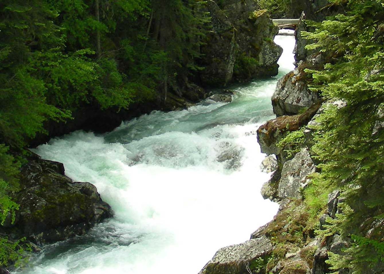
The Lostine River
drains the Eaglecap Wilderness
|
|
Natural Resources II: Water
Lecture 06
Email
me
Unit
Organization:
Reading:
Textbook:
Chapter 9
Ancillary Reading:
Water as a resource
Water
is needed for personal use (drinking, cooking), for household uses (cleaning,
sewage, garden), for consumer uses (almost every retail store, from restaurants
to storehouses, use water), for industrial use (during the manufacturing
process, clean-up, and removal of both solid and soluble wastes, and as waste
output from the manufacturing process), and for agricultural use, mostly
irrigation.
An
important point here is that we consume this resource in two ways
- directly
as fresh water
- indirectly
as polluted water (which removes water from use just as does drinking it)
Water on
a smooth Earth, would cover the planet to a depth of 2 miles, but almost
all water is not immediately available as a resource:
| Source |
Proportion of total |
| Oceans |
97.400 % |
|
| All Ice |
01.980 % |
|
| Antarctic Ice |
|
01.960 % |
| All Other Ice |
|
00.020 % |
| Groundwater |
00.590 % |
|
| Lakes |
00.007 % |
|
| Soil Moisture |
00.005 % |
|
| Atmosphere, Rivers, Life |
00.001 % |
|
The
Water that is readily available is found in lakes, impoundments, rivers,
and in some groundwater regions known as aquifers
- Oceans
are salt water, as are some lakes
- Ocean
composition is about 3.5% salt by weight (usually expressed as 35 parts per
thousand or ppt)
-
19.00
ppt Chlorine
-
11.00
ppt Sodium
-
03.00
ppt Sulphate
-
01.00
ppt Magnesium
-
00.50
ppt Calcium
-
00.50
ppt Potassium
-
00.05 ppt 30+
other ions
A
problem for you: The ratio (by weight) of sodium to chlorine in seawater
is 1 Cl : 0.58 Na. The
ratio of these elements (by weight) in table salt (NaCl) is 1 Cl : 0.65 Na. Why
is there relatively less sodium in sea water than you would expect based
on table salt? Solution in class (if some one is willing to enlighten us).
Physical properties
of water:
You
should be familiar with these:
- Cohesion's
effect on boiling point and solvency power, and surface
tension of
water along with the ideas of latent heat of vaporization and freezing
- Adhesion's
effect on hydrophily
- Water's
unusual density and the concepts of specific gravity and specific heat
- Expansion
of water as it freezes causing ice to float and water to reach its greatest
density at 4° centigrade
Water Supply
Fresh
water is the most readily available water
- All
fresh water comes from precipitation
- The
fresh water we use can come from either renewable or non-renewable sources
Renewable
Water Sources
What
happens to precipitation that falls on land (if it falls on the ocean, it
is lost as a source)?
- 65%
runs off the land in floods and is lost as a resource
- about
1/3 of the rest falls on uninhabited land and is not used
- The
rest (about 7,000 cubic km worldwide) remains in rivers, streams, and groundwater
we can potentially use
- Impoundments
(artificial lakes upstream of dams, sometimes called drowned rivers)
have increased the total resource to about 9,000 cubic km worldwide
- Currently,
direct consumption and pollution use up almost all of the 7,000 cubic km
available without impoundments
Water supply is not evenly distributed world-wide
because precipitation is not distributed evenly worldwide
- Deserts are the regions of poor rainfall and, thus, poor water supply
- Australia (driest continent) western US and
most of Mexico (Great Basin, Sonoran, and Chihuahuan Deserts and Short
grass Prairie regions), West of the Andes from
20° S to the equator (Atacama Desert), central Argentina (Chaco and Pampas),
northeastern
Brazil
(Sertao
and Caatinga regions), most of
Africa
above the Equator Sahara Desert), much of southern Africa (Kalahari and
Namib Deserts), the Middle East, and Central Asia (Gobi Desert) are all
dry areas
Surface Waters:
Lakes and Rivers
Both
are important water resources
- We
won't bother trying to separate rivers from streams and creeks or lakes
from ponds so all flowing water for us is in rivers and all basins filled
with water are lakes (no mention of wetlands at all in this chapter)
- Many
centers of early civilization were associated with water supplies
- Rivers
and large lakes supplied water and food, replenished soil nutrients, and
facilitated transport of goods while carrying away waste
When
water falls on land, where it goes depends on the contour of the land
- Water
collects in low areas and flows from low area to lower area
- Watersheds (Drainage
Basins) are all of the land where precipitation flows into a
particular river or lake
- Thus,
we can define the Cumberland River Watershed, which is part of the Tennessee
River Watershed, which is part of the Mississippi River Watershed
- Watersheds
can either
- empty
into the sea (or empty into another river that eventually flows to the
sea)
- have
no outlet other than evaporation (usually the lowest
area is a lake but some closed watersheds have rivers that simply
dry up)
- Watershed boundaries rarely match well with
political boundaries
- Dams store water and alter flow through the
watershed
- Colorado River is an example of overuse of
a watershed
- 100 MYA, the region was Pacific Ocean
but 50 MYA, the Rockies began to form and the Colorado was born
as a much
smaller river and, as more land accumulated in the Southwest,
the Colorado grew until, about 5 to 12 MYA it began discharging into
the Gulf of Mexico
- Colorado River is over 1,450 miles long and
drops over 10,000 feet along that course
- Upper River is 200-500 feet wide and Lower
River is 500-1000 ft wide with an average depth of 10 to 30 ft (now as
low as 2 ft after water removal near mouth)
- Colorado Watershed comprises the southwest
corner of Wyoming, the western half of Colorado, the eastern half of
Utah, the pointy bottom of Nevada, and all of Arizona
- Colorado begins in the Colorado Rockies, runs
west out of the mountains, into Utah where it flows southwest across
the Colorado Plateau into Arizona near Lee's Ferry, across northern Arizona
to where AZ, NV, and UT touch, then turns south, where it forms the boundary
between California and Arizona, and crosses a narrow strip of
Mexico before discharging into the uppermost
part of
the Sea
of Cortez
(= Gulf of California)
- Lee Ferry marks the divide between the upper
and lower basins of the watershed
- Major tributaries are the Green, San Juan,
Little Colorado, Virgin, and Gila Rivers
- The river has carved many Canyons
from the sedimentary rock over which it flows (Grand, Gore, Glenwood,
De Beque,
and Cataract Canyons are some - Black Canyon now Lake Mead)
- Man has altered the flow with 29 major dams
and hundreds of miles of canals
- Largest dams are the Glen Canyon (Lake Powell),
Hoover (Lake Mead), and Imperial Dams
- Total capacity of the dams is over 4
times average yearly flow
- A drop of water entering the top of the watershed
will be taken up and used 17 times by man before it gets to the Gulf
- Water has irrigated previously non-productive
land (Imperial Valley, CA and southwest Arizona)
- Imperial Valley produces $350 million of crops
per year
- (ASIDE - Some of the Imperial Valley is, like
Death Valley, below sea level. The Colorado's delta
built a dam across the upper end of the Gulf of California
which turned the sea floor
into land. Early attempts to divert Colorado River water to Imperial
Valley allowed flood
waters
from
the
river to
flow into the valley, where they created the Salton Sea in 1905 and evaporation
has increased the salinity to 44 ppt, greater than seawater)
- Dams provide 12,000,000 kw of
electricity per year
- Colorado is named for its once-red colored
water
- Due to the red rocks that provide the sediment
but dams now trap the sediment and the water is green
- From 1922 until 1973, the Colorado Water Compact
was slowly negotiated by six states and Mexico, all of whom wanted water.
- The negotiated total is 16.5 million acre-feet
of water out of a total yearly discharge of 27.5 million acre-feet
- The yearly total is an average
based on measurements taken at Lees Ferry for 20 years before
1920
Colorado River Water Allocation |
User |
% of 16.5 maf taken |
US |
90.9% |
|
|
California |
|
26.7% |
|
Colorado |
|
23.5% |
|
Arizona |
|
17.0% |
|
Utah |
|
10.4% |
|
Wyoming |
|
6.4% |
|
New Mexico |
|
5.1% |
|
Nevada |
|
1.8% |
Mexico |
9.1% |
|
| Total |
100% |
|
- Tree-ring studies suggest that those were
some of the wettest years in the last 1000 years and that 13.5 is a more
accurate average
- Since 2000, the river has been at or above
average volume only three years
- Environmental Impacts
- Trapping sediment behind dams
- Filling of impoundments
- Lake Powell will fill in from 3 to 7 hundred
years
- Delta in Mexico is starved of sediment needed
as nutrient for wetlands and algal growth in the Gulf
- Loss of nutrients and nursery areas
have severely reduced shrimp, fish and sea mammal populations
- Reuse of water has increased saltiness of
water
- Once, the salinity of the lower basin was
50 ppm but is now over 2000 ppm
- Salinity damages crops
- Bureau of Reclamation
estimates that, in 1997, $500,000,000 loss in US and $100,000,000 in
Mexico
- US built a large desalination plant
near Yuma, AZ (1/4 billion $) and has just tested (2011-2012)
the plant at 1/3 capacity for a year to satisfy treaty obligations
with
Mexico
as the Colorado River water is now too salty to be useful for
agriculture when it arrives in Mexico.
- Dams release water from lower portion of lake,
where water is cold
- Normal temperature range is 32° in winter
to 85° in summer, now almost always 46°
- Recreational boaters now die in summer
from hypothermia
Groundwater
- Precipitation
that does not run-off percolates into soil and the underlying rock and
is called Groundwater
- The
rock must be porous (sandstone or fractured limestone or granite)
- Layers
of porous rock are Aquifers
- Water
in aquifers flows from areas receiving precipitation to discharge into
lakes and rivers
- Zone
of Saturation -
lower zone, where water fills the voids in the rock
- top
of saturation zone is the top of the Water
Table
- Zone
of Aeration -
upper zone where walls of voids are wet but also contain air
- Recharge
areas are the source areas for the water (from precipitation)
- Man
has added a second discharge: withdrawal of water from wells
- Wells
create a Cone of Depression of the water table that is deepest at the well
- Current
data indicates that most aquifers take up to 200 years to completely recharge
(turn over the water once)
- Layers
of rock that are not porous are called Aquicludes (shale,
siltstone)
- Many
areas have many layers of porous and non-porous rock
- Wells
tap groundwater resource
- Artesian
wells are those where water pressure from areas where the water table is
high cause water to flow without pumping (in effect, man-made springs)
Problems
with groundwater supply
- Groundwater
pollution
- Organic
compounds, radioactive compounds, and excess salt have started to appear
in US groundwater
- Unlined
landfills (or leaky lined landfills), leaky aboveground
and underground storage tanks, old or poorly maintained septic
tanks are common POINT sources
of pollution
- An additional source of point groundwater
pollution was due to the practice of injecting pollutants into
deep wells to store the pollutants
- this practice was founded on the
faulty assumption that once injected, the waste would stay
put
- Most states prevent this practice today
but laws abroad are not so restrictive
- Pesticides
and fertilizers applied to agricultural lands (and, to a lesser extent,
to suburban lawns) and road salt are important sources of NON-POINT source
pollution
- Flow
is slow in groundwater (often no more than 50 ft per year), so pollutants
remain concentrated in small areas for longer periods than polluted surface
waters
- Dickson,
TN has a severe groundwater pollution problem from dumping TCE and PCE
(tri- and perchloroethylene - either may cause cancer) in county landfill
- Surrounding
wells have been polluted and it may cost up to $1 billion to clean up
- As
most of those affected were African-Americans and most of those who authorized
the dumping were not, the case has racial implications
- Poor
communities, often communities of color, often are chosen as places to
discharge pollutants
- Overuse leading to depletion of groundwater and a lowering of the water table
- Can
dry up streams where table is close to surface
- Overuse
can cause Land Subsidence
- Some
areas have subsided over 30 feet
- Subsidence
causes surface problems (foundations crack, roads fall apart, etc.)
- Subsidence
causes subsurface problems
- Voids in
the rock collapse, so that the rock ceases to be an aquifer
and groundwater resource is reduced
- Subsidence can have many causes:
- Grounwater loss (pumping or extended
drought)
- Sink hole collapse of rock in Karst
regions
- Pumping of natural gas
- Collapse of mines
- Earthquakes causing Faulting
- Faulting due to deeper motion in the Asthenosphere
- The aesthenosphere responds to the deposition or loss of mass at
the surface by depressing or rebounding
- Lake Bonneville mass depressed
the aesthenosphere 200 ft and, as the water had dried up,
the aesthenosphere rebounded so that the center of the
Bonneville flats are 200 feet
above the edges (not so flat, huh?)
- Salt
Water Intrusion - near the ocean, withdrawal of water
can allow salt water to replace fresh, poisoning water supplies
Non-Renewable Water Sources
Fossil-Water
Aquifers
- Some
porous layers of rock recharge very slowly or not at all because the porous
rock, once exposed to recharge, is now sealed off by aquacludes
- The water in the aquifer may have been stored
there millions of years ago
- There is little or no recharge for such an aquifer
- Much
of the agriculture of the US is irrigated with this "fossil" water
- Largest
and most important fossil aquifer is the Ogallala Aquifer, now half depleted
and the rate of withdrawal is increasing
- No
viable plans exist to replace this water source with another once it is gone
Demand for Water
- Some
startling figures:
- US
uses 408,000,000,000 gallons of water per day
- That's
1,143 gallons per person
- Who
do you know that drinks a thousand gallons of water per day?
- Individual
Use is a small portion of the per person per day figure
- Withdrawn
Water - water taken from the source
- The largest "withdrawer" of water are
electricity generating plants, which use the water for cooling
- This water is returned without much
chemical alteration but is returned with another sort of pollutant: waste
heat
- This heat can change the temperature
of the body of water from which the water is drawn, altering a
fundamental physical parameter that may alter the composition of
the community in the generation plant's environment
- This form of pollution can be mitigated
by using cooling towers that heat the air
- Consumed
Water - water taken from the source and not returned
(a subset of withdrawn water)
- logically, consumed water can equal but never
exceed withdrawn water
- Water
that is returned may or may not be suitable for subsequent use depending
on the quality of the returned water and the specific use (drinking or
car washing?)
- What
do we use water for? From the use the consumes the most to the least:
- Agriculture
- Industry
- Municipal
(including water supply to residences)
- Reservoir
Losses (most to evaporation, some to groundwater)
- California
agriculture uses about 1/3 of all US water and everyone in the US (and many
in other countries) eats what those farmers produce
Responses to Demand
Efficiency
and Conservation
- Consume
less and preserve the resource
- Much
water is supplied at less than cost to agriculture, so farmers do not
invest in efficiency and conservation as much as they would if water were
a greater
cost
- Drip
Irrigation (Microirrigation) delivers water slowly to crop root zones and
avoids run-off and evaporation losses
- Irrigation
canals and reservoirs lose water to evaporation and leakage back
into the groundwater, so improved canals and covering canals can reduce
loss
- When
water costs rise to industry, the incentive often increases efficiency
or promotes technological changes to reduce water consumption
- Meat
is more costly (in terms of water) to produce than vegetation, so a less
meat in the diet conserves water
- The
cost of a cow is the water needed by the cow plus the water needed to grow
the cow's food
- Homes
can reduce water usage per flush, flush less
- Xeriscaping (xeri-
is a prefix meaning dry) can reduce suburban water use by using plants
adapted for dry conditions
Desalination
- Using
technology to remove salt from water
- Two
approaches:
- Distillation - evaporated water leaves the salt behind
- Cost is in the heat needed to get evaporation
rate high enough to produce significant fresh water
- If waste heat from electricity generation or
from industrial processes is used, the efficiency of distillation can compare
well with osmotic processes
- Osmosis
- Reverse
Osmosis-
using hydraulic pressure to force water across a membrane that won't
let salt pass
- Normal
osmosis resists this, so lots of pressure is needed to make much water
- Using
straight sea water clogs membrane pores, so this process is much more efficient
if brackish water is used
- Forward Osmosis (newer technology) - Heat-labile
salts are added to water to a concentration greater than seawater, so osmosis
moves water out of seawater, across the membrane, and into the salter water
(called the Draw Solution). After absorbing as much water as it can,
the draw solution is heated, which drives off the salts, leaving almost
pure water behind
- No pressurization is needed but energy cost
is due to heat needed to drive off salts
- Most efficient way to do this is to use waste
heat from electricity generation or from some industrial process
- Both
methods have environmental costs
- Costs
associated with energy needed to heat water or to apply pressure
- Costs
associated with disposal of salt produced
Waste Water
Reclamation
- Much
reclaimed water is reused but not for direct consumption
- Sewage
treatment plants can reclaim water
- Multi-step process:
- Primary Treatment
- Separates solids
suspended in the water by sedimentation (settling out)
- Skims off oils from top
- Secondary
Treatment
in tanks that use natural recycling
processes
- Uses Aerobic Decomposition to remove
dissolved and suspended organic material through bacterial digestion
- Waste can now be released or, preferably,
treated more
- Tertiary Treatment
- Chemical and physical (e.g. fine
filtration) treatment to disinfect, clarify, and remove remaining
dissolved pollutants
- Treated fluid can be
- released into a river or lake
- released into a natural filtering
system for further improvement in quality
- Wetlands, sometimes constructed for
this purpose, and some golf courses, can be used in this way
- released into the groundwater
for further filtration and natural processing
- Solids, now called Sludge,
are processed according to the types of material in the sewage (so
not all sludge is treated alike) to disinfect it, remove pollutants,
and to control odor
- Sludge might be used to produce
methane (natural gas) in Anaerobic Digesters and the gas
used for electric generation
- Sludge might be burnt, and the
heat generated may be used to generate electricity
- If the sludge meets standards
for pollution and disinfection, it can
be used as fertilizer
- Sludge that does not meet criteria
for combustion or agricultural use may simply be put in landfills
(most sludge)
- Designed to handle organic waste
efficiently but other pollutants (heavy metals, man-made organics like
PCBs) are
less efficiently removed
- Industries
can be required to treat their own water
- Sewage systems are often part of the overall
Storm Water System
- Good in that it forces storm runoff to be treated
as sewage and not simply allowed to run into lakes and streams
- Bad in that storms may produce so much runoff
that the sewage system's storage capacity is overwhelmed and raw sewage
may be released into lakes or rivers
New Dams,
Canals and Reservoirs
- Building
new dams and reservoirs will increase water resources by retaining more run-off
for later use
- Dams
are not always built to increase water supply (hydroelectric power, flood
control)
- Environmental
Impact of dams
- Removal
of normal sediment load from rivers
- sediments
accumulate in reservoirs
- sediments
do not build deltas or fertilize wetlands and shallow offshore sea water
- Increased
erosion below dam
- Reservoirs,
especially those in hot, dry areas, lose lots of water to evaporation
- Evaporation
increases salinity of the water
- Dam
Breaks can cause disasters
- Biological
Disruptions (fish migration, alterations in fish, invertebrate and plankton
communities due to temperature changes, etc.)
- Alteration
or destruction of natural and human communities
- Canals do not increase the supply but do redistribute
it from areas of surplus to areas of scarcity
- Canals often have large costs
- reduce water available to natural systems (Florida
Everglades)
- destroy productive wetlands ("Drain the Swamp")
- Social disruption caused by the diversion
Social Implications of Water Supply
Is there a
"Water Crisis"?
- Certainly,
water is in short supply in some parts of the Earth
- The
Third World Center for Water Management claims that there is enough almost
to satisfy the demand if sufficient technology and efficiency are applied
- Will
efficiency and technology be able to meet future demand? The center
does little forecasting
Who pays for
water?
- Agriculture
often receives water subsidies in the form of lower prices for water
- These
are often less than 1/10 of what urban consumers pay
- Inexpensive
resources get wasted, expensive resources get conserved
- As
prices rise for water, farmers use less by increasing efficiency or choosing
crops with lower water demand
- This
policy of charging those who use the resource the real price, with environmental
costs included, puts pressure on farmers, industries, and households to reduce
water consumption
Who controls water?
- Water
is a resource that has a long legal and political history but the regulation
of water usually pertains to surface water
- Less
is known about ground water movement
- Surface
Waters:
- Riparian
Laws - empower those who own the banks of a river to withdraw water from
it
- usually
requires that not so much water can be taken that would seriously
reduce the water available for downstream owners
- Riparian
Laws come from common-law, practices built up over many years and eventually
codified
- Riparian
Law is more common where water is relatively plentiful (eastern US)
- Appropriation
Laws predominate in the western US
- The
first to use the water has the right to it, and this right supercedes any
rights due to ownership of the banks
- Thus,
a rancher who has pumped water from a stream has the right to the water and
someone who moves in upstream must leave that water in the stream, even though
he or she owns the banks of the stream
- This
means users have rights tied to time of first use, not rights tied to where
they own land along a river
- Beneficial
Use Law gives the water to the user who makes the most beneficial use of
it
- These
laws are similar to Eminent Domain laws, which allow the state to take property,
with compensation, in order to use it for the general good (often an ill-defined
concept)
- Thus,
if an industrial facility is using water but very wastefully, the state can
take that water, with compensation, unless the industry agrees to cut the
waste from its process
- Groundwater
- Few
laws but in may places, it is assumed that those who own the surface of the
land can use the groundwater under it
- However,
wells can deplete water under adjacent owner's land and laws are accumulating
that regulate the right to pump freely from a well on one's own property
- Groundwater
pollution is harder to regulate, as nothing can stop the lateral movement
of the water and so, any pollution will eventually move to adjacent owners
land
Case Histories of Water Use Disputes in the US
- The Everglades
- The everglades are a shallow river system
that flows from Lake Okeechobee in central southern Florida to the
tip of Florida and discharges into the Florida Bay
- The area was once coral reef and is very
flat, which accounts for the river's odd dimensions
- Coral is calcium carbonate, and so south
Florida is composed of Marl (unconsolidated calcium carbonate) and
coralstone (consolidated calcium carbonate)
- These conditions are unique and the ecosystem
that developed is also unique
- Florida Bay is an important resource for
shellfish, commercial, and sport fisheries
- The everglades are home to the largest populations
of water fowl in the US (or once were)
- To develop the area, drainage canals were
used to divert water to the ocean or gulf north of the everglades so
that the water table would drop and expose land for construction
- Much of this occurred in the 1950's and
the area just south of the lake was turned into fields for sugarcane
- The diverted water was used by households,
industry or agriculture and the excess was simply released into the
Ocean or the Gulf
- The diversion of water exposed more land,
which was mostly used for residential construction, and the increase
in population
used more and more of the water
- Problems soon surfaced
- The peat soils were mostly humus and, when
exposed, crumbled and eroded such that the average soil depth when
the canals were built (5 ft) has declined to less than 3 feet on average
(cane needs 3 ft) and productivity had declined since the 1980's
- Humans introduced exotic species of plants
and animals that further damaged the system
- Melaleuca, a species of fast-growing,
root-sprouting tree from Australia, used as an ornamental, has overgrown
many acres
and it's high rate of evapotranspiration had lowered the water table
where it grows in abundance (Florida natives are adapted to wet, not
dry, soils)
- Pythons have reduced mammal populations
(deer, mustelids, raccoons, etc.) where they have become common (by
as much as 90% for some species) (the largest one found so far was
over 17 feet long and pregnant)
- So little water was left in the glades that
bird populations declined and some species left the area altogether
- A coalition of public and private agencies
put together a plan to restore flow to the glades but, according to
an independent oversight committee involving the National Academy of
Sciences, the plan has not gone forward quickly enough to prevent
further damage to the system
- LA began looking for more water to support
growth in the late 1800's and the Owens Valley, between the White
and Sierra Nevada Mountains, had water and far fewer people
- The distance between LA and Bishop, the
largest town in the Owens Valley is 250 miles due north
- LA acquired water rights (often through
political influence at the state level but also by buying water rights
from land owners) and built an aqueduct (canal) from the valley to
LA by 1913
- Many Owens Valley residents claim
they were told that the water was for residential use only
and not for agriculture (not true) and when the project began,
LA residents were told that there was a water crisis (also
not true but, if LA was to become LA, just proactive)
- Promises to preserve Owens Valley
agriculture were made but broken
- The aqueduct was costly to build and operate
because it had to pump water over elevated land between the valley
and LA
- By the 1920's, so much surface water was
diverted to LA that agriculture in the valley, their main source
of income, was severely affected
- Although residents sought to destroy the
aqueduct, they were unsuccessful and by 1926 Owens Lake was gone
- By 1928, LA owned 90% of the water and
agriculture ceased to be economically viable in the valley
- In 1972, a second canal was built to remove
groundwater pumped for LA's use
- Owens valley springs and seeps dried up
and desertification set
in
- Lawsuits followed to make LA return some
water and the Owens Valley won but LA has never returned enough water
to stop the process of desertification in the valley
Fracking, gas production, groundwater
and the law
- As
we learned earlier, fracking involves the injection of a slurry of materials
into deep layers of rock with trapped gas
- The
pressurized fracking liquid pulverized the rock and releases the
gas
- Most
of the fluid is returned to the surface and there are some regulations about
handling this waste safely
- For
the fluid in the ground, the energy industry claims that it is trapped in
the shale by un-fracked layers of rock and will not mix with groundwater
- This
is not a well-tested (no pun intended) assumption and data is now
being collected as fracking activity has skyrocketed since the discovery
of significant
amounts of shale
gas
- If
there are cracks in the "impermeable" layers of rock, then contamination
can occur
- The
most likely crack is the one made by fracking - the bore hole drilled to
get the fracking fluid to the shale layer
- Currently,
there are regulations about sealing that hole while fracking and once the
fracking is completed but no one has tested thoroughly if the current methods
really are an efficient seal or how long the seal lasts
- No
one knows what the effects of earthquakes may be on these "sealed" fracking
wells
- It
is known that fracking can cause (minor) earthquakes
s22
Last updated November 29, 2012