|
BIOL 4140
Contemporary Problems
in Environmental Science
Phil Ganter
302 Harned Hall
963-5782 |
|
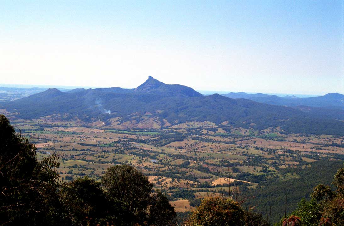
Extensive habitat fragmentation
in Australia (Mt. Warning in the distance) |
Natural Resources IV Part 1: Land
Lecture 09a
Email
me
Unit
Organization:
Reading:
Textbook: Chapters 12
& 13
Ancillary Reading:
Land Management
The
idea of land management is a complex set of practices intended to affect
the value of land, whether privately or publicly owned
- Management
may mean optimizing or maximizing the land's value with respect to several
uses for the land including
- Agricultural
Production
- Mineral
Extraction
- Ecosystem
Services
- Recreation
- Conservation
of Natural Capital
- In
the US, all land is owned, either by the government or by private individuals
(some of whom, according the Supreme Court, may resemble corporate entities
but are really individual citizens)
Government Land
The
federal government is the largest land owner (about 31% of the total)
- Much
of it is in the western states
- Much
of it is mountainous and arid (20% of federal land is in NV, AZ and
UT) or mountainous and frozen (35% of federal land is in Alaska)
The
states own about 9%
Government
owned lands are used for:
- Office
space
- military
and militia bases
- parks,
reserves, wilderness areas
- leased
to private individuals or corporations for commercial exploitation
- Agriculture
- Forestry
- Mining
Stewardship
Many
groups interested in land management promote the idea of stewardship
- Stewardship,
when used in this context, is an ethic which seeks to maximize the value
of something indefinitely.
- Value
here is not fungible but that value specifically linked to the resource being
stewarded
- Stewardship
would never involve harvesting all of the blue whales now and investing the
money in other enterprises, even if that would maximize monetary return,
as the return from those monies would not come from future harvests of blue
whale, the resource being stewarded
- Thus,
good stewardship is not always consistent with good business
Public Land
Management
Although
there are many ideas on how best to manage public lands, the differences
can be summed up by comparing two schools of thought:
- Preservation - minimum current use of natural capital, maximum preservation of future
value, leaving wilderness as wilderness
- Conservation - exploitation of public lands' natural capital
- Conservationist
philosophy has dominated in the public forum and in the national and state
legislatures
- Conservationist
practices have generated lots of wealth but there are two aspects of the
wealth generated that are receiving greater attention today than in the recent
past
- Much
damage has occurred to the lands being used
- Overgrazing
- Abandoned
Mines
- Reduction
of both old-growth forest and total forest area
- Wealth
generation has not always been in the public good due to direct and indirect
subsidies from public funds
- Waste
is generated by land users, waste cleanup is often paid for by public funds
- Access
to the resources on public lands is often far less expensive than similar
access on private lands (for ranching, mining and logging rights)
- Grazing rights are often
far less than the market would bear (mineral rights
and timber rights are also undervalued)
- Federal rules allow a rancher
to get a mortgage on the value of their grazing permits,
which forces government officials to consider the possiblilty
of forecloseures on ranchers personal property when
making decsions about the uses of federal lands (the
value of these loans is over 1/2 billion dollars)
- The
persistence of these subsidies are due to organized opposition
from the western states, where much of the wealth is generated
but opposition to the subsidies
comes from the more populous eastern states, which pay a
disproportionately large part of the cost of the subsidies
NEPA and the
EIS
- National
Environmental Policy Act (NEPA) of 1969 is the fundamental law regulating
environmental protection of federal lands
- Requires
all "major" federal actions involving those lands be reviewed for
environmental impacts before proceeding
- A
component of the review process is the Environmental Impact Statement (EIS)
which is supposed to be a science-based assessment of the benefits and impacts
of the proposed project
- Many states have enacted similar statutes which
govern protection of state-owned land and state-initiated projects
Private Land
Management
- Although
many governments world-wide have set aside lands for either conservation
or preservation, public lands will not be enough
- Preservation
of majority of species requires at least 10% of habitat for each biome (14
are officially recognized by the IUCN)
- Currently,
11.6% is protected, which looks good but actually fails to protect 10% of
each biome
- Antarctica
accounts for 5.5% of all protected lands, leaving only 6% for protection
of most species
- Much
of the remaining protected land is either desert, mountain or other land
with little commercial value
- Much
of the protected land is poorly managed (due to lack of resources allocated
by impoverished governments or to political instability)
- Much
protected land is fragmented and actually preserves less
of the core habitat than the actual acreage preserved
- So,
some private lands must be preserved if we are to preserve a majority
of species
- Methods
for preserving private lands:
- Limiting ownership rights
- The Endangered Species Act may limit use of
privately held lands in order to preserve habitat for endangered species
- Such regulations must balance the historical
rights of land owners with demonstrable public good
- Often compensation (usually monetary) is offered
by the regulations in lieu of land owner rights
- NGO
(Non-governmental Organization) purchase of lands for preservation
- Nature
Conservancy is a good example - members have donated sufficient money
to purchase and preserve 15,000,000 acres in the US
- The
organization does not, as a rule, buy lands in other countries but
seeks partnerships with governments to help them preserve land)
- Started
in US in 1951 but works in 30+ countries and claims to have protected 120,000,000
acres of land and 5,000 mi of rivers worldwide and is known as one of the
most efficient of all charitable organizations
- The
NC buys land selectively for its environmental value (high diversity, rarity
of the habitat, corridor between fragments, etc.)
- Conservation
Easements - land owners can sign a CE, which prevents certain uses of the
land and permits others (like living on the land, some forms of agriculture)
- Conservation
Easements, once in force, remain in force as long as the land is privately
owned, even when sold to other private individuals (sale or confiscation
by the government breaks the easement)
- Conservation
Easements often come with tax benefits for the owners of the land
- The
Nature Conservancy sometimes buys lands, signs a conservation easement, and
then resells the land to private individuals, which allows the organization
to reuse its funds multiple times
Preserves
National
Park System
- Yellowstone first park (1872) and the system has grown since
- Now
includes parks, rivers, ruins, battlefields, monuments, homes, etc.
- 84,400,000+
acres
- 3%
is privately owned
- Largest
is Wrangell-St. Elias NP in Alaska (16% of total park system area)
- Smallest
is Thaddeus Kosciuszko National Memorial in Philadelphia, PA (0.02 acres)
- Park
recreational use has skyrocketed, which has resulted in two separate
economic demands on the system
- Maintaining
the park services in existing parks
- Creating
new parks to relieve the pressure of increased use in existing parks
- Park
funding, which has taken a precipitous decline since the 2008 fiscal crisis,
is skewed toward the second demand
- It
is easier to get funds for a new monument or park rather than get funding
for operating costs, even though new parks mean increased operating costs
- Suggested
solutions:
- Removing
parks from the system (if under utilized or if there is local support for
their maintenance)
- Increasing
revenue from users
- Limiting
use to minimize operating cost
- Restoring Federal Funding
Wilderness and
Multi-Use as part of the National Park System
- By
1900, Conservationist philosophy had come to dominate policy about public
lands
- This
gave rise to the doctrine of Multi-use Management of public lands
- Multi-use
management seeks to balance all uses to maximize total benefit from public
lands
- 1964
Wilderness Act allowed public lands to be set aside as wilderness
- Due
to degradation of natural capital on public lands, Preservationist
approaches began to attract adherents and in 1964, the Wilderness Act
was enacted in order to preserve some public lands
- Lands
designated as wilderness are not Multi-use Lands
- No
permanent structures, no roads, no commercial use, no motorized vehicles
- Now
757 wilderness areas totaling 109,501,440 acres (California is 101,571,840
acres)
- Arizona,
California, Alaska, Nevada, Idaho, Washington and Oregon have the most wilderness
- All
of Tennessee's wilderness areas are near the TN-NC border and are relatively
small
- Connecticut,
Rhode Island, Delaware, Iowa, Kansas, and Maryland have none
(New Jersey has wilderness - The Brigantine (now the Edwin B Forsythe)
National Wildlife
Refuge
- (side
note - the acre was once related to how much land a team of oxen
could plow in a day but is now related to the surveyors use of
the square mile as a
basic unit for the original surveys of newly acquired US territories. Subdividing
the square mile by successive halvings
of
the
sides
of the
square
- 4 parcels
(first halving), then halve each of the parcels and get 16 parcels
of land, each of 40 acres - thus, each square mile is 640 acres
[40 x 16] - The Homestead
Act of 1862 [inspired by the Free Soil movement] granted title
to a section [160 acres, 1/4th sq. mi.] to settlers who improved
the
land and lived on it for
5 years
-
Between 1862 and 1934, 270,000,000 acres were homesteaded by 1,600.000
grantees [10% of all the US] - the acre
is the reason for the use
of "40" in the expressions "the back 40" and "40 acres and
a mule")
- Often
local opposition to the designation, as it may mean some current uses of
the land become prohibited
- Perceived
economic loss is usually claimed but studies have shown little impact
National
Forests and National Grasslands
National
Forest Service administers both, but grassland acreages
are typically 1/10 the acreage of a typical national forest
Forest system created by the Land Revision
act of 1981 to protect a watershed that supplied water to Los Angeles, CA
The grassland system was created in 1937 as part
of the Bankhead-Jones Farm Tenant Act, which, in addition to setting up a
credit system to help tenant farmers buy the land they farmed, allowed the
federal government to acquire and rehabilitate damaged lands
About
1/2 of all of the commercially valuable wood is found in the National Forest
system (commercial use is permitted on National Forest land but not in
National Parks)
- Multi-use of
these forests and grasslands leads to conflicting priorities
- Uses
of the systems include
- Timber Harvesting
- Grazing
- Water Storage and Purification
- Wildlife Preservation
- Recreation
- All
uses can't be maximized or optimized at once
- Logging may reduce value as wildlife refuge
and for recreation
- Grazing or logging may reduce amount and
quality of water available
- Loss of logging or grazing rights may impact
local economies
- Conservation
vs. Preservation
- Preservation
is more difficult for dedicated multi-use lands, as a decision
to preserve land today can be reversed tomorrow but clear cutting
an old growth forest or
removing the top of a mountain as part of a surface
mine
that is done
today can't
be reversed tomorrow
- As
the Forest Service spends more on building roads and maintaining recently
cut forests than it collects from logging leases, the public subsidizes the
timber industry
- There
are also controversies over methodology
- Clear
Cutting (Even-Age Forest Management is the euphemism)
- Cutting
and removal of all valuable timber at one time
- Replanting
of selected (often just 1) species (essentially turning the forest into a
kind of field crop)
- Benefits
of clear cutting
- Maximizes
revenue at time of harvest per acre of land leased
- Costs
- Increases
soil erosion and can silt up streams
- Extensive
road network needed (roads cause more erosion, fragment the
habitat, and encourage access to core habitat)
- Ugly
- Large
stands of trees of the same species and age (often genetically similar as
well) can promote disease and insect pest outbreaks and cause catastrophic
tree loss
- If
one tree in the stand is at risk, all are at risk
- Selective
Cutting (Uneven-age Forest Management)
- More
costly per tree harvested
- Avoids
many of the other costs (or minimizes them)
- Fire,
Timber Harvest, and Forests
- Wildfire
management has become more and more important (see Lecture 4 for information
about wildfires)
- Controversy
has arisen over the approach to wildfires (are they a natural
event or a tragic human disaster, or both?) and how to manage them
- Bush
administration took two controversial steps
- Launching
the Healthy Forest Initiative in 2002
- Gave
loggers access to burned areas to remove dead trees
- Gave administrators of each
forest the power to favor local priorities and ignore
wildlife preservation concerns when
making wildfire prevention policy for the lands they
administer
- Often, the result of the
policy is that loggers are allowed to cut trees in
the effort to reduce fuel
for fires
- Environmental groups have criticized
both aspects of the initiative
- They claim that there is little
evidence that logging is either the best or even
an effective means of fire control
- They have also pointed
out the potential for conflicts of interest as forest
administrators sometimes take jobs
with the same logging companies to which they have
given logging permits
- Reversing
the Roadless Area Conservation Rule (promulgated during the Clinton administration)
that prevented road building in wilderness areas
- The
reversal gave states the power to build roads for state purposes on land
held in trust for all US citizens, not just state residents
- Congress passed the Federal
Land Assistance, Management, and Enhancement Act (FLAME Act) in 2009 in order to
find a compromise solution acceptable to all stakeholders
Marine
Reserves
- Protection
of marine resources through the establishment of marine reserves is a more
recent development than protection of terrestrial resources through the use
of preserves
- The
ocean has traditionally been treated as a commons, where all nations may
take resources
- Fishery
collapses have lead to treaties and treaty organizations tasked
with setting and monitoring marine resource extraction
- Traditionally,
all nations had jurisdiction over coastal waters within 3 nautical
miles (= 1.15 mi or 1.85 km) of their coastline
- Set
by practical considerations when proposed (the
distance offshore a shore-based cannon could reach)
- It had
become obsolete by the mid 1900's and some countries were claiming much wider
offshore territories
- United
Nations Convention on the Law of the Sea (1982, in effect in 1994, currently
160 nations are signatories)
- Establishes
a 12 (22 km) nautical mile territorial right for all nations, and sets up
additional zones
- 12
nautical mile "contiguous zone" outside of the territorial zone for problems
with customs, immigration, taxation and pollution that originate within the
territorial
zone
- 200
nautical mile Exclusive Economic Zone giving control of marine resources
to the adjacent country (often sets fishing rights) but does allow navigation
and overflight by all nations
- The
EEZ can be extended to the edge of the continental shelf (not more than 350
nautical miles or 100 nautical miles past the depth of 2,500 m) but it protects
only mineral and non-living resources (oil and gas, usually)
- Also
sets up many organizations to monitor and regulate marine resources
- Marine
Protected Areas
- International
program, administered by the IUCN, has several types of MPAs
- Almost
always
multi-use and often not very effective as means of conservation
(only 0.01% of ocean is a no-fishing zone)
- 5,880+
marine protected areas (2010) covering only about 1.2% of the ocean's
surface
- Chagos
Archipelago is the largest at 250,000 sq mi (= a square with 500 mile sides)
- Yellow
Tang (aquarium fish often captured from the wild) - first fish to
demonstrate that marine reserves have wide benefits (larvae from marine
reserve drifted
100
km and
re-stocked
a
reef
depleted
by overfishing)
- In
the US, most MPA's are due to state action, not federal
- National
Marine Sanctuary Program (legislation enacted in 1972)
- 13
sanctuaries and 1 national monument have been designated so far (nothing
since 2000) and are administered by NOAA
- Most
are for habitat protection (coral reefs are popular) and 2 are for shipwrecks
(the monitor, where it sank off of Cape Hatteras (NC), and a shipwreck cluster
in Lake Huron
Preserve Design
Which
land to preserve
- Historically,
the US has chosen spectacular landscapes far from population centers and
of low commercial and agricultural value for its national parks
- Other
considerations have emerged since then and the trend has been to switch away
from protecting only unique habitat to protection some of all habitats:
- Protection
of species (Europe chose to protect habitat of large game animals)
- Protection
of unique habitats
- This
was often done through the use of Umbrella
Species -
large, charismatic species that would ensure the protection of
other less charismatic species sharing the same habitat
- Biogeographers
mapped diversity and, from such maps, Hot Spots (areas of unusually great
biodiversity) could be designated and protected
- Hot
Spots are identified by
- The
number of endemic species
- The
degree of habitat loss in the hot spot
- 34
high priority hot spots have been identified with at least 1,500 endemic
species (plants, mammals, and amphibians combined) and 70% habitat loss
- The
total area for all hot spots is 1.4% of land area
- Encompass
75% of threatened species (plant, mammal, and amphibian)
- Encompass
50% of all know plant species
- Encompass
42% of all known mammal species
- Hot
spots for different types of organisms do not necessarily coincide (birds
vs plants)
- Hotspots
for biodiversity are congruent with hotspots for human languages, which are
disappearing at a greater rate than species
- Protection
of all biomes
- As
evidence of degradation accumulates for all biomes, it becomes
clear that protection must also be extended to all biomes
Desgin
of Preserves
- Shape
of the Preserve
- Should
minimize edge effects to maximize the amount of core habitat protected
- A
circle has the least % of its area affected by edge effects and the % increases
as the shape departs from circularity
- Fragments
must be interconnected by corridors sufficient to allow migration
- Buffer
zones can minimize contact between core species and human habitat
- Buffer
zones may be mixed use areas while core is wilderness
- Size
of Preserve
- Large
mammals and birds may require large preserves
- If
that is impossible, then networks of fragments with corridors may be the
only viable alternative
Sustainable
Management
Many
hot spots are already home to many people and often their standard of living
puts them at risk of poverty, disease, and exploitation
- Establishment
of preserves that do not balance the conservation of biodiversity with the
needs of those living in the hot spots is both ineffective and indefensible
- Sustainable
Management is the set of practices which seeks to manage preserves both for
conservation and for development of local populations
- The
strategy is usually to generate jobs and economic value from the preserve
for local populations
- Management
and Research jobs (governmental)
- Ecotourism
- Sustainable
Harvest of wild plants and animals
- Keeping
economic value of harvest local can be difficult
- Bioprospecting
for pharmaceuticals has generated lots of wealth but little for local populations
- History has shown that little
value has accrued to the populations where the new pharmaceutical
originated, although great value has accrued where the
technology existed to develop the new drug
- Convention
on Biological Diversity (http://www.cbd.int)
- Treaty
signed by over 150 countries (the US signed it but the Senate has not
ratified it)
- Promotes
conservation of biodiversity, sustainable use of wild organisms, and fair
sharing of benefits arising from genetic discoveries
- Nagoya
Protocol on Access and Benefit Sharing (2010) adopted to set up a legal framework
for giving all access to genetic resources and for sharing of benefits arising
from genetic resources
- Too soon to evaluate effect of the agreement
Urban Management
Worldwide,
the trend is toward an ever-growing proportion of humanity living in cities
- Urbanization
went over 50% by 2009
- USA
- 82%, Canada - 81%, United Kingdom - 80%
- The
most urbanized large country? Australia at 90% (not consistent
with your image of Crocodile Dundee and the Outback?) is the most urbanized
large
country (not including nation-cities like Singapore, small desert countries
like Kuwait, and some small European countries like Belgium and Luxembourg)
Causes
of urbanization:
- Rural
flight
- Industrialization
- Urban
Population Growth
Results
of Urbanization
- Growth
of urban landscape
- Development
of suburban area
- Many
cities have seen the suburbs grow in both acreage and population while
the city declines in population (Suburban Sprawl)
- Suburbs
tend to be single-story residences, while multi-story residences are more
common in city centers
- Reasons
for sprawl in the US
- Inexpensive
gasoline and public expenditures on transportation geared toward road building
rather than public transportation
- Desire
for personal space (love your lawn)
- Escape
from perceived dangers of city living
- Inexpensive
land and housing (always new construction on the fringe of suburb)
- Attitude
that a change from an agricultural field or pasture to a residential development
necessarily constitutes a public good (usually called "progress")
Effects
of sprawl
- Increased
reliance on individual transportation vs. public (with resulting increase
in per capita energy use)
- Increased
sq. footage or residences and acreage per resident (also with increased
per capita energy use)
- Fragmentation
of economic and environmental systems (earn money in city, pay taxes
in suburbs, each suburb has its own sewage and garbage system, etc.) with
concurrent
increase in energy use per capita
- Decrease
in wildlife habitat (although varmints like deer and possum seem to do well)
- Decrease
in resident's physical fitness (mainly due to more driving and less walking)
- Decrease
in social connectedness for the average individual
- Reduced
access to social services (especially important for those who must rely on
public transportation: the elderly, those confined to bed or wheelchair,
those who cannot afford cars)
- Increase
in Sealed Surface Area
- This
is the area covered by buildings, concrete, asphalt, and other
materials that will not allow water to percolate into the soil
- This
means the water will become run-off, which can result in flash flooding,
a lowering of the water table, dry river and stream beds during dry parts
of the year (insufficient supply from groundwater), and an increase in water
pollution in local waterways
- Water
that runs off carries pollutants directly into streams whereas water that
percolates into the ground will allow filtration and the activity of soil
organisms to contain and even degrade the pollutants
Alternatives
to Sprawl
Urban
planning is the most effective means of reducing sprawl and it involves
- Planning
transportation to service the city center
- Avoiding "ring
roads" that encourage more sprawl outside of the ring
(some cities have multiple rings that have lead to increased
problems with sprawl)
- Public
transport investment to reduce energy consumption and pollution production
- Multifamily
housing
- Multiple-use
development (combined office, commercial, and residential space in multistory
buildings)
- Riverside
land can be used for recreation, flood buffer zones, water filtration
areas, storm water reservoirs, and wildlife habitat all at once
- Sequential
use development - reusing land no longer in use (Brownfield
Development)
- Old
factory sites can be recovered for other uses
- Natural
Siting Criteria (use of land based on considerations
other than property values) may also produce an increase in the quality
of life for city residents
and a simultaneous reduction in environmental impact of development
- Siting
of new development based on considerations of geology, hydrology, and wildlife
potential
s22
Last updated October 26, 2012